Two million hectares of Indonesian forests lost to fires since June: Report
JAKARTA — More than two million hectares of forest area have been reduced to ashes in the past five months in Indonesia, according to the data published by the National Space and Aviation Agency (Lapan).

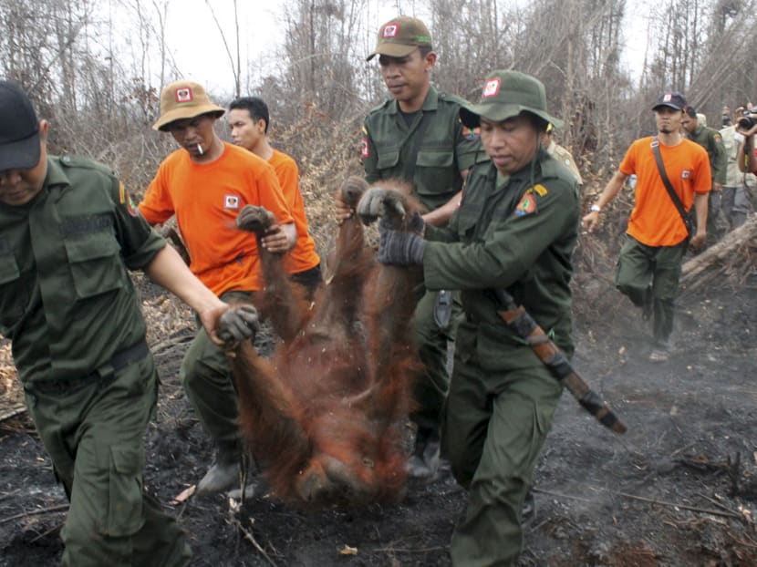
Natural Resources Conservation Center (BKSDA) officers and members of the Orangutan Foundation evacuate a 19-year-old female orangutan from a forest area affected by fires near Sampit, Central Kalimantan on Oct 28, 2015. Photo: Antara Foto via Reuters
JAKARTA — More than two million hectares of forest area have been reduced to ashes in the past five months in Indonesia, according to the data published by the National Space and Aviation Agency (Lapan).
The agency said on Friday that based on satellite data collected from June 21 until Oct 20, an estimated 2,089,911 hectares were gone.
The number is likely to grow, as a large number of forests — as well as peat lands — are still fire, causing the ongoing haze crisis, especially in Kalimantan and Sumatra.
“We have compared the data gathered from before and after the fires started,” Mr Parwati Sofan, a senior official at Lapan, told a press conference on Friday (Oct 30) at the Natural Disaster Mitigation Agency (BNPB)’s headquarters in Central Jakarta, as quoted by kompas.com.
Lapan estimates that 832,999 hectares of forests were burned in Sumatra, 806,817 hectares in Kalimantan, 353,191 hectares in Papua, 30,912 hectares in Sulawesi, 30,162 hectares in Bali and Nusa Tenggara, 18,768 in Java, and 17,063 in Maluku.
BNPB spokesman Sutopo Purwo Nugroho said that 32 per cent of hotspots in the country are currently found in non-concession forest areas, 20 per cent in industrial forest areas (HTI), 20 per cent in palm oil plantations, and the remainder was found in forest areas used for other purposes.
“Even though the satellite has helped us [collect the data], bear in mind that it cannot scan the forest areas that are covered in thick haze and clouds,” Mr Parwati added. “We expect the number to increase as the data collecting is still underway. We will update the data every ten days.”
The BNPB and its local branches have set up numerous shelters for residents of the affected regions.
The Indonesian Red Cross (PMI) on Thursday sent extra ambulances, water trucks, water purifiers, shelters, air purifiers and eye drops to Sumatra and Kalimantan. The PMI has extended its haze emergency response period to January, as the disaster still shows no signs of abating. JAKARTA GLOBE


