China launching satellites to monitor 'every reef and vessel' in South China Sea and beyond
BEIJING — China will launch satellites next year that will allow it to closely watch and reinforce "national sovereignty" throughout the South China Sea, according to state media.

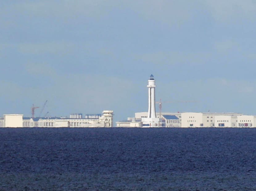
China has reclaimed thousands of acres of land in the waters of the South China Sea, and built ports, runways and other military infrastructure on seven artificial features it has created.
BEIJING — China will launch satellites next year that will allow it to closely watch and reinforce "national sovereignty" throughout the South China Sea, according to state media.
By 2021, China will have a total of 10 satellites - six optical, two hyperspectral and two radar - that will keep a real-time daily watch on the contested waters and monitor key areas several times a day as part of the Hainan satellite constellation system, China News Service reported.
Global Times separately cited experts as saying that the monitoring system could cover as far as the Indian Ocean and part of the Strait of Malacca, and give China an advantage in negotiating maritime borders as well as support its Belt and Road Initiative.
The satellite programme is being carried out by the Chinese Academy of Science's Sanya Institute of Remote Sensing under sponsorship from the government of Hainan, China’s southernmost island province.
Mr Yang Tianliang, director of the institute, said the network would enable authorities based in Hainan to speed up their response to emergencies, more effectively administer the South China Sea, and improve exploration and development of the resource-rich waters.
"Each reef and island as well as each vessel in the South China Sea will be under the watch of the 'space eyes'," Mr Yang said.
"The system will [reinforce] national sovereignty, protection of fisheries, and marine search and rescue."
Chinese space experts had reviewed and approved technical plans for the first four satellites at a meeting in Sanya on Tuesday, China News Service reported.
In the programme's first phase, three of these optical satellites will be launched in the second half of next year. They will be equipped with optical remote sensors, a system to identify ships and cameras designed to monitor the ocean's surface.
Each of these satellites will weigh 50kg, and will operate 500km above Earth and move at 7.9km per second, the report said.
"The combination of cameras and automatic identification systems will allow us not only to monitor ships lawfully sailing in the South China Sea, but also to detect and track illegally operating ones," Mr Yang said.
The network's initial priority was to cover all of the South China Sea so the cameras in the first three satellites will be strong enough only to focus on large and mid-sized vessels, the report said.
The two hyperspectral satellites to be launched in the second phase in 2020 will be able to assess water conditions, while the synthetic aperture radar satellites to be sent into orbit in the third phase will be able to provide all-weather, high-definition monitoring.
Mr Yang told another state-owned newspaper, the Global Times, that when the network is completed, it will cover areas between 20 to 30 degrees north and south from the equator.
"This can cover important areas such as the Indian Ocean and part of the Strait of Malacca," Chen Xiangmiao, a research fellow at the Hainan-based National Institute for the South China Sea told the nationalistic tabloid published by the Chinese Communist Party.
Mr Chen said the satellite system will give China an advantage in negotiating the demarcation of the disputed waters.
China claims more than 80 per cent of the South China Sea, a thriving fishing zone which carries around US$3.4 trillion worth of global trade each year. Five other countries including the Philippines and Vietnam also claim parts of the same maritime area.
According to Mr Yang, data on passing ships, reefs and water quality "can be readily provided to less developed countries along the Belt and Road Initiative, if needed".
The initiative, unveiled by President Xi Jinping in 2013, aims to develop a network of land and sea links with South-east Asia, Central Asia, the Middle East, Europe and Africa.
Plans to develop the satellite system were first announced in December last year.
“The Chinese seem to have moved very fast on this,” Mr Collin Koh, a research fellow at the S Rajaratnam School of International Studies in Singapore, told Bloomberg.
“Couching all this under an ostensibly civilian looking programme that has numerous military and maritime law enforcement applications has far-reaching strategic ramifications for the South China Sea disputes.”
China has reclaimed thousands of acres of land in the waters and built ports, runways and other military infrastructure on seven artificial features it has created.
In June, United States Secretary of Defence James Mattis warned Beijing that it would face consequences in the long term that could persuade it to change track with regard to the South China Sea.
“I believe there are much larger consequences in the future, when nations lose the rapport of their neighbours,” Mr Mattis told the Shangri-La Dialogue in Singapore. AGENCIES


